Hasty vs Grid: Drone Search and Rescue in the Real World
No Time To loose
When someone’s missing, there’s no time for guesswork. That’s why organized Search and Rescue (SAR) teams use proven methods—like hasty searches and grid patterns—to cover ground fast and thoroughly.
Drones don’t replace ground teams, but they do offer a serious advantage to the first responders when used with intention. Here I’ll explain how we apply these traditional SAR techniques in the air, and when it makes sense to bring a drone into the mission.
Why Search Strategy Matters
Flying around aimlessly with a drone might feel helpful, but it can actually slow things down. That’s why SAR teams use structured methods and track Probability of Detection (POD)—basically, how likely it is you’ll actually find what you’re looking for in a given area. Drones can plug into that system, if the pilot understands how coverage and terrain interact. Drone first responders train for this. Otherwise, it’s just wasted flight time and battery. In the case where there are possibly multiple pilots in the air, having a Deconfliction Policy is paramount to prevent injuries and unnecessary loss of equipment, and search delays.
Remember, outside of the incident command structure, there is NO place for an un-announced drone flight. If you feel you want to participate as a drone pilot, you will have to be a recognized member of a SAR organization, or your role will be strictly off the controls and determined by the incident command structure.
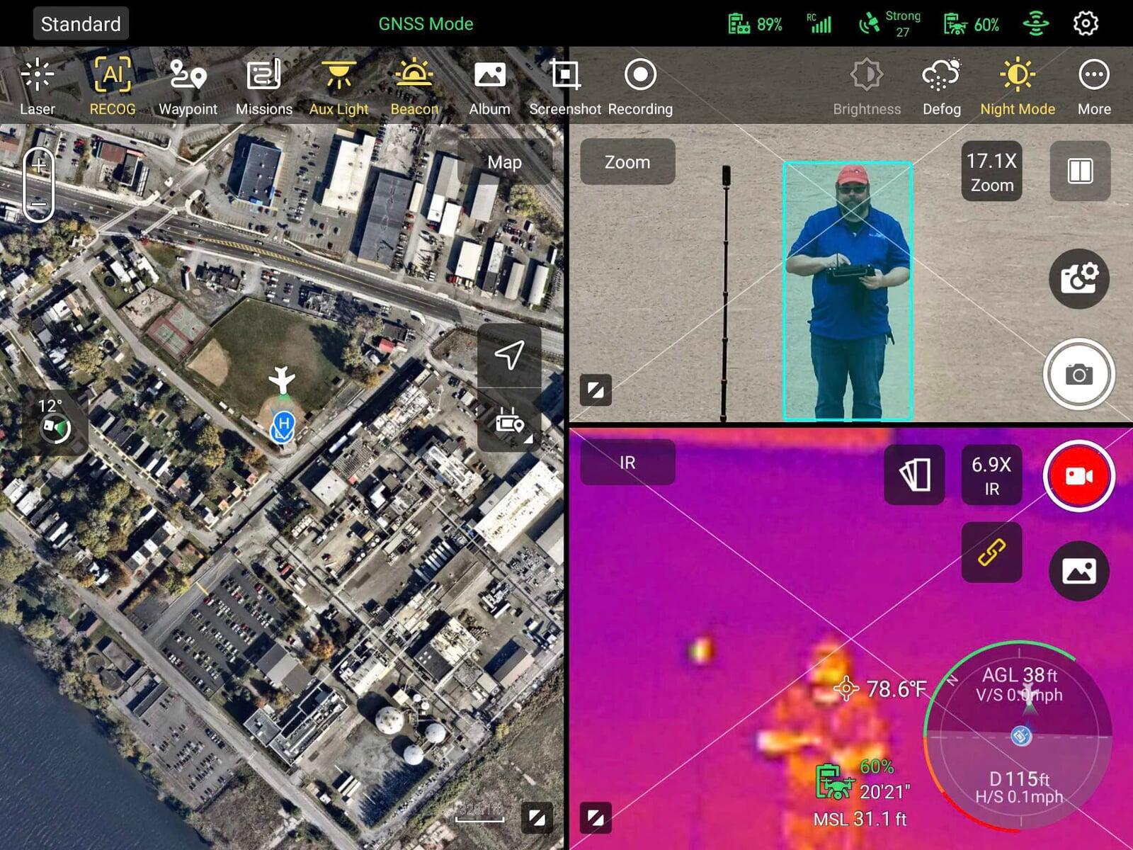
Aerial Hasty Searches
A hasty search is the fastest first-pass method we use. On the ground, that might mean checking a trailhead, driveway, or wooded edge near a house.
With a drone, it means flying quick loops or thermal scans around the last known point (LKP). We’re looking for movement, heat signatures, open areas where someone might be visible, or signs that need closer inspection. it might mean following a road or checking around outbuildings nearby, or just taking a guess about direction and checking things out until you lose line of sight on your drone.
This method works best:
When you have a good idea of where to start
In open terrain like fields, parking lots, or neighborhoods
When time is short and you need a quick “yes or no” before committing more resources
I use thermal imaging when possible—especially at night or in shoulder seasons where a human body contrasts better with the background. Using most drones there are options such as AI image recognition for humans, as well as highlighting which makes thermal imaging highly sensitive to people.
Grid Searches with Drones
A grid search is slower, but more thorough. We program the drone to fly overlapping lanes over a defined area, reviewing video or thermal imagery as it appears, often with a visual observer. In my support work, we generally use a 40 inch tv and multiple team members viewing the data to ensure we have "eyes" on at all times.
With the right planning, you can document exactly what was seen, from what angle, at what time—something not always possible on the ground. There are even options to communicate with the victim, light up the area, and provide high accuracy location data. That makes it easier to contribute to tools like WinCASIE III, which some SAR teams (like ours in Rensselaer County) use to track search effectiveness and plan next moves.
Grids have some limits:
- They’re time- and battery-intensive
- Coverage depends on altitude, resolution, and pilot awareness.
Aerial can also be tedious, and looking at the same screen of similar data for any length of time leads to a visual fatigue that is difficult to combat. One technique for this is to simply change the thermal palette, or the false colors generated showing different heat signatures.
All drone SAR techniques are limited by battery and pilot fatigue, which is important for incident commands to be aware of.