Thermal Imagery
Why Choose Sky Photos for Thermal Imaging?
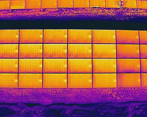
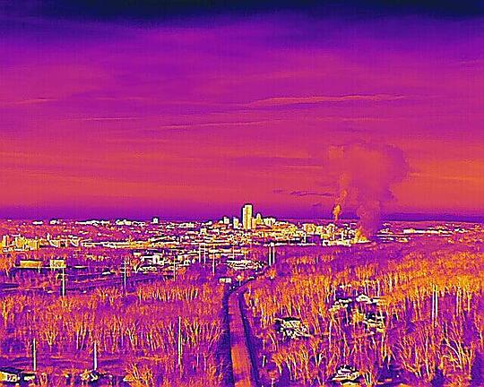
Thermal (infrared) imaging detects temperature differences on surfaces, visualizing heat as color variations in a photo or video.
This imagery provides a unique insight into your project, giving you data about heat, water flow, and behavior in your environment. With high accuracy it can measure temperatures as well as identify the relative differences in temperature at significant distance.
Precise thermal image data can record temperature data for every pixel, allowing for precise temperature measurements and detailed analysis.
Our FAA Certified Chief Pilot Craig is Thermography-1 SUAS certified and has experience with incident management, operations, and night flights. Sky Photos thermal equipment includes calibrated, drone based thermal imagers with laser rangefinding for locating exact points. With fast turnaround times we can provide quick, useful an meaningful data.